River flooding#
River flooding, which is also referred to as fluvial flooding, is caused by unusually high water levels in rivers, caused by increased runoff from heavy or prolonged rainfall. Flooding occurs when the amount of water exceeds the capacity of the river channel, and overtopping of river banks occurs.
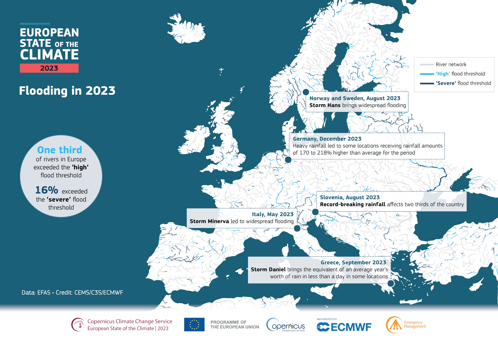
Flooding can result in damage, displacement, economic losses and in some cases loss of life. The image below shows an overview of river systems in Europe and recent flood events as shown in the European State of the Climate 2023 report by Copernicus Climate Change Service.
In this workflow we will focus only on the fluvial flooding hazard (flooding directly around rivers). Due to coarse resolution, the flood maps included in this workflow are only representative for larger river basins. For those basins we will explore how river flooding changes under climate change with help of Europe-wide datasets, and demonstrate an example of calculating economic damages to infrastructure due to river flooding. This workflow can be adjusted by the user to be able to make use of local flood maps which can be more representative of the local situation than Europe-scale maps, which might lack detail and include not all streams or processes.